White Rim Trail, Canyonlands National Park - May 3-5, 2002
If you succeed in downloading all the huge pictures in this trip report, then you
may want to point your mouse here to download a huge video (don't even bother if you don't have a
highspeed connection):
Here is a 16MB Windows Media clip
or here to get a smaller one (still don't bother):
Here is a low quality 7MB version
Delta Airlines
I arrived at Sea Tac airport 1h15m before my flight Thursday afternoon. Perhaps
a little tight in the aftermath of 9-11, but I had been slowed by unexpected traffic.
When I got to the Delta checkin counters 15 minutes later,
there were only about a dozen people in line in front of me - no problem. I waited a
few minutes. The line didn't move. Some other people were using the express checkin
machines. What's the deal with those - can I use them? Last time the only requirement
was that you bought your ticket with a credit card, which seems really weird to me.
What's with all these different ways to checkin? Sky Cap, Express... it's disturbing,
a entire little airport caste system.
A view of Mt Adams from the plane. Pretty obvious
east/west difference in weather here.

I accost a Delta employee, who tells me in broken English that, yes, I can use the express
checkin. It start the process, and the machine tells me that I must see a Delta representative
in order to checkin. Uh... ok.
Back in line, I wait another 25 minutes. It's now one half hour before my departure
time. There are only one or two employees serving customers.
My turn comes. As I approach the counter, I hear the representative speak into a phone
"okay, anyone on flight 542 is now going to miss their flight". I immediately slap
my ticket down on the counter and say "I'm on flight 542".
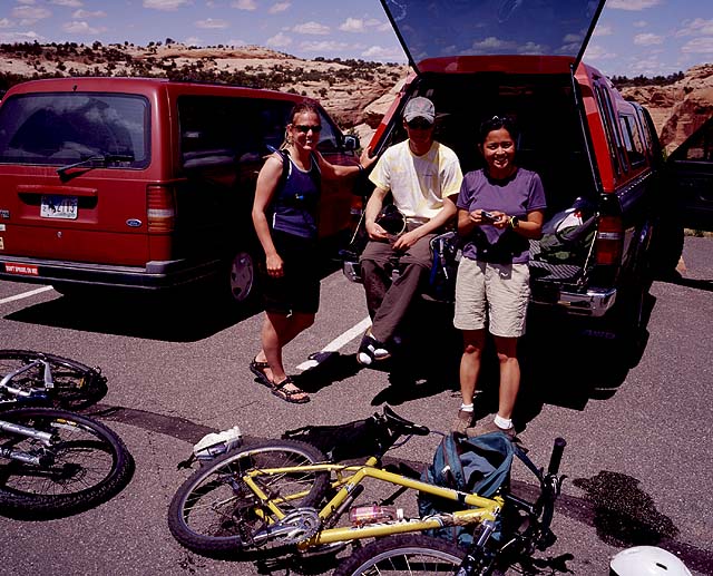
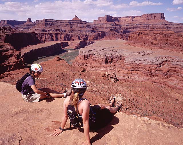
Kathie, Damion and G at the trailhead.
There is tension in the air. I mention that I've been in line for half an hour. She looks
at me with disgust: "You have *not* been here for half an hour" (but I have).
She begrudgingly begins
handling my ticket, before asking me "How do you want to pay for that?", pointing to
my bike box. I am charged an $80 over-size baggage fee for my bike. Some airlines
make exceptions for bikes, but not Delta. I make my opinions known, and the
conversation with the representative ends with her rudely agreeing that I should choose
another airline next time. Uh, yup!
The security is way more intense than it was over Christmas. There's about 30 people
at the checkpoint, searching people. They don't like my shoes, so I have to take
them off and they put them in an X-ray machine to make sure they are bomb-free.
However, they allow me to take my sharp ski-crampons in my carry-on (somehow they
were forgotten there from last weekend). Interesting.
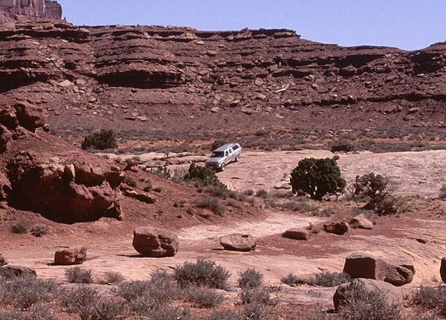
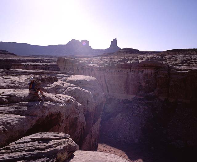
The White Rim trail starts at around 6000ft on top of the
Island In The Sky, and winds down through cliffs to the actual White Rim

Putting my bike back together
I had to remove my fork to get my bike to fit in the box. Now I had to reassemble it
in G and Damion's garage in SLC. When I disassembled it in Seattle, little pieces
went flying everywhere (spacers, ball bearing housings, little washer things)
so I figured I'd better make a diagram of how they fit together. In the garage, my
diagram isn't making any sense. Finally after almost an hour of advice and attempts,
I get my fork solidly back on. I didn't assemble it quite correctly though, and
I'll discover a few days later that I seem to have permanently affixed my fork to my
frame.
G rounds a switchback next to huge canyon walls on the Shafer descent
Ben's
Ben's is a little diner in Green River, on the way to Canyonlands N.P. The doors on
the stalls in both the men's and women's restrooms, when shut, lie about 4 inches behind
where your knees would be. And their first attempt at a vegeterian omelet had ham in it.
But they had some tasty chocolate and coconut pie.
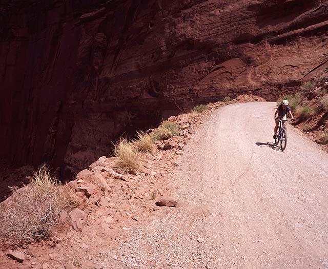
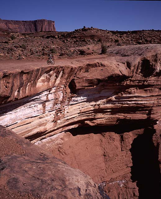
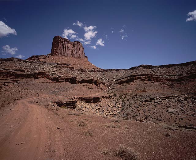
Further down the Shafer.

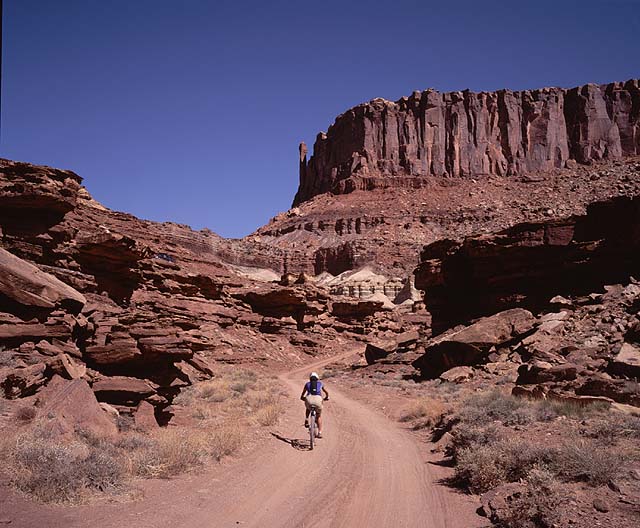
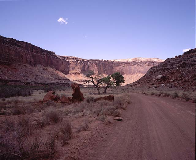
The Shafer Trail
Going clockwise on the White Rim, you start down the Shafer Trail (actually
a road), which drops about 1400ft
off the plateau. It's slightly technical on a bike, because of a few soft sandy
sections - we weren't used to riding sand (at least me), and it takes a little
getting used to. We passed lots of riders and cars, huffin and puffin their way
back up. Damion was the designated driver for our sag (Rob's truck) today, so he
stood at a lookout near The Neck (with a good view of the Shafer) and took video.
Gambrelli was sure he'd be napping as we biked into view, but nope, he actually got some
great footage. We biked down the steep switchbacks between vertical mesa walls,
passed some prayer group, and finally emerged onto the flats... the White Rim itself!
Rob rides across Musselman arch. There are about a
million pictures of this on the internet. Pretty cliche, but also pretty
dramatic
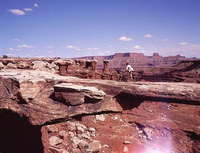
Musselman Arch
Damion and the truck finally caught up to us just before Musselman. This is a
spectacular long thin arch suspended way above the floor of the canyon. Well,
nothing to say except it's pretty cool. Rob was the only one gutsy enough to ride
across it. Kathie said she'd divorce him if he did it again. It didn't seem to deter
him, but then she said she'd get to keep the truck.
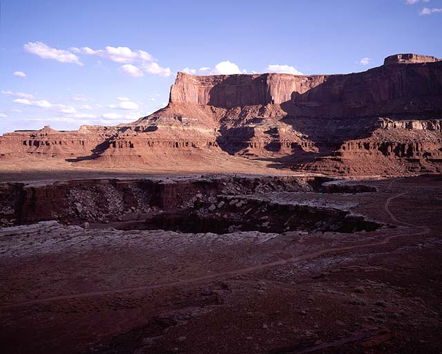
A view of our camp, in the shadow of Airport Tower.
The outhouse is prominently visible just above the shadow.
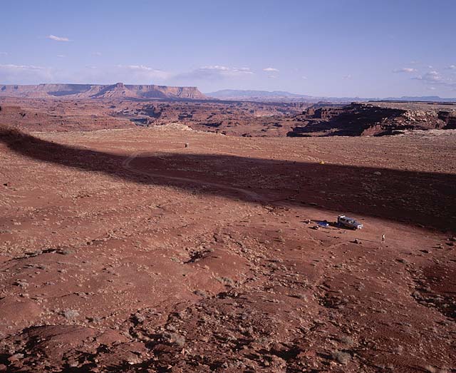
Airport Camp
Our first camp. It had taken us about 4 hours to travel 20 miles today. And
Damion said he'd had trouble keeping up with the bikes in the truck. We had
some Sangria and beer and other stuff, and relaxed and ate until night fell.
It was a windy night, almost sleepless for me in my flappy tent. I rotated the tent
90 degrees halfway through the night, so the wind would stop blowing the side wall in
my face. A few minutes later, the wind shifted by 90 degrees for the rest of the night.
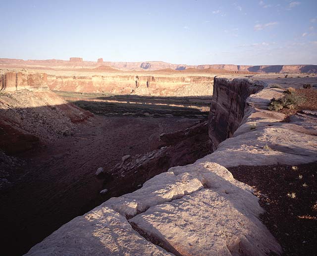
I have no recollection of where this is, but I think
that's the Colorado River down there. G and Kathie engaging in some girl talk.
Many many canyons
Today's 35 miles would take us down the east side of the mesa, and halfway back up
the west side. The morning was beautiful and peaceful, with no other people in sight.
We passed by Airport Tower, Monster Tower, and a bunch of cool big ampitheaters.
Gambrelli at side canyon "apex".
The road takes a very indirect route, forced to weave back and forth to circumvent
all the side canyons indenting the White Rim plateau from the Colorado River. This
is cool though, because at each canyon's "apex", you get to ride right next to
the rim and look down into the starkly overhanging headwall.
Here you can clearly see the White Rim Trail rounding
the indented canyon. Such raw terrain.
After four of these
large canyons, we arrived at a long flat sandy stretch around the south end of the mesa.
Here we had views into the maze of columns in Monument Basin.
Phil looking into Monument Basin.
Kathie doing some friction climbing in Rob's truck.
Chad and Buffy's
By this time, traffic had increased. Bikers were out in force, and most of them
seemed to be coming the opposite direction (of course). Every one of them was
decked out in slick-looking matching lycra. We made fun of them, but actually,
they were much faster than us. Too bad for them, I think we got to see more stuff.
As it was, we certainly could have used more time to explore... next time, a 5 day
trip! There were side trails and ruins and artifacts and natural features we never
got to see.
Damion unleashed!
Damion, pent up from driving the truck all day yesterday, only rode with us for the first
5 miles or so, then disappeared and got ahead of us by several hours. The other
big question for today was - when would Jeff (Damion's dad) and Milan meet up with
us? They were vehicle-only, but they'd need to do some serious driving to catch up.
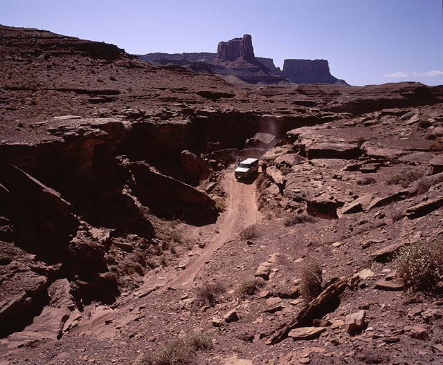
The dreaded Murphy Hogback
We didn't really know too much about the route. All we had was a topo map. It looked
like it was a little climb over a 5200ft pass. The White Rim road became more and more
hilly as it climbed back north on the west side of the mesa. A few moderate hill climbs
led to the final steep climb up the Hogback. So far I had been impressed with the
road. It's just a road, so kind of boring terrain, right? Not really, there was
a good mixture of steep, rocky, sandy sections, and flat smooth sections. Murphy
Hogback did not disappoint. Rob went up first. Next was Kathie in the truck, then
G and me, both walking our bikes. I have no shame! Definitely not a trivial uphill.
A big drop off to the left too, if you veer off the road. At the bottom of the road
were some people milling around a truck that had lost its brakes, and the emergency brake
was quickly losing its effectiveness too. Their camp was on top of Murphy, but they
couldn't bring the truck up (imagine what would happen if it began slipping on the
steep climb!). I read somewhere that you can expect to pay in excess of $1000 in towing
fees to get a vehicle driving the White Rim back to civilization.
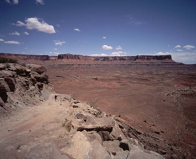
G walking her bike up Murphy Hogback. The White Rim Trail
shown with red dots.
The road was so steep and slick (sandy dust on rock)
that Gambrelli even took a fall on foot! Imagine
then how it was for Kathie doing the scariest driving of her life in Rob's truck.
The truck stalled a short distance from the top in a rocky section, and she had to
back up to get going again, with people watching from on top.
After a rest on top, time to go down. The first 50 feet were steep
hard rock topped with sand,
and I elected to walk that section before getting on my bike and enjoying one long
downhill.
Winding roadway on the other side of Murphy's
Endless canyons
The remainder of the ride to our second camp, Candlestick, was deceptive. You
keep seeing the next stretch of road 100 yards in front of you, but it's like a mile
away, because you keep winding around these little side canyons and washes. There's
not a single bridge on the entire 100 mile trail - you either drop down into the canyons
if possible,
or go around them. In general, this section was slightly downhill though, so it was
sweet. G arrived at camp first, followed by me and Kathie. The camps are most
prominently identified by the outhouses, visible in the flat desert from miles away.
They are beacons of light, drawing you near. The lifeblood of the White Rim.
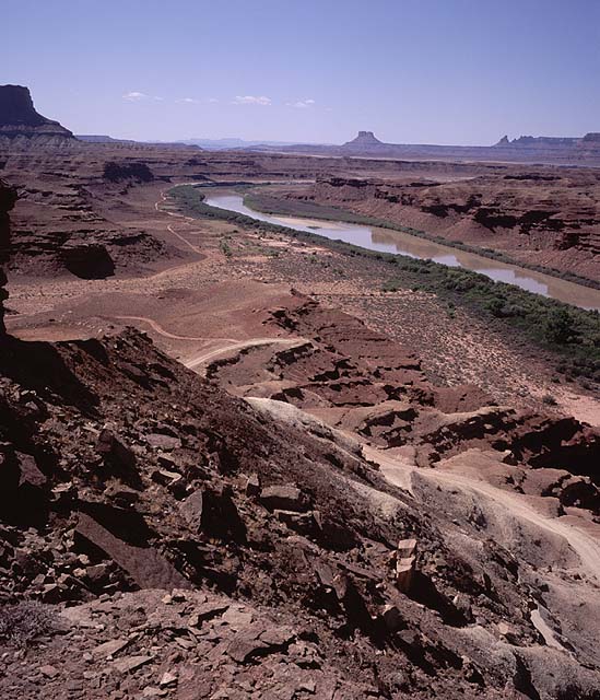
The view towards the Green River from near Candlestick Camp
Rob soon arrived in the truck, with Damion in tow (Damion had fallen asleep under a
shady rock atop Murphy Hogback, it was only by chance that Rob had noticed him before
heading back down the other side in the truck). It was 4 o'clock, we had 4 hours
of daylight left. Four hours in the hot sun.
Jeff and Milan arrive
They arrived about an hour before dark, beating all our time estimates. It was
Milan's first time ever camping outside. Right on! Jeff said they met a south-african
guy with his 2 wheel drive car stuck somewhere around airport camp. What was he
thinking bringing a 2wd vehicle here? They hauled him out of his sticky situation,
after which he pondered: "Now I don't know whether to continue, or head back!". Back!
For dinner, my canister stove proved it's total awesomeness when used in the hot desert.
It seemed to be able to boil a litre of water in 30 seconds!
For dessert, Rob and Kathie treated us to another pot of chocolate pudding. Yum!
G on the rim near Holeman Slot. The Green River does
a big oxbow here and penetrates far into the plateau. Candlestick Tower in
the background. (This is the picture I took after you see me hopping along some rocks,
camera in hand, in the video).
Day 3
Our last day began with a long, generally downhill 10 mile section. We passed by
the Holeman slot canyon, but I don't think any of us new what lay down in the depths,
so we didn't explorer it. Gradually, the road dropped lower and lower, getting
closer to the Green River. Finally at Beaver Bottom we were right next to it.
Some flattish riding brought us to our next uphill. There was a name for it, but
I forget. It was a side ridge of Bighorn Mesa.
G biking up out of Potato Bottom. Suprisingly,
the column in the background doesn't have a name on any of the maps. Call it "column 5050". The
road passes right beneath it.
Rob on bike, and Kathie the truck driver
The road seemed to vanish into cliffs.
Where did it go? Another few hundred yards of riding brought us through a little
trench where the climb began. Cool stuff, this would be the perfect place to plan
an ambush from the cliffs above.
View back down to Potato Bottom from the ridge. The road
can clearly be seen alongside the river, then climbing up towards the
bottom right of the photo, then back to the left-center.
The road became a series of steep rocky switchbacks. Finally it flattened out and
continued on an exposed traverse to the beginning of the descent. We could see the
road 400ft below us, and Hardscrabble Camp. It disappeared amongst the cliffs, and
reappeared in the sandy flats below. Time for some fun downhill! An up and down
traverse across the cliffs brought us to a long sandy downhill. Little patches
of soft sand are annoying/dangerous on the descent, but when its continuous sand,
it becomes an altogether different affair, and had kind of a cool skiing feel.
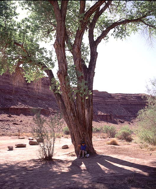
I ran for shade of a lone tree (hot and windless today) near the bottom, while G waited for the others to
arrive.
G under a tree in Hardscrabble Bottom
After eating lunch we continued on the often sandy valley bottom road. Jeff and Milan
took off ahead of us to try to catch to Damion, who had disappeared again, just
like yesterday.
The river canyon narrows here. It was mostly peaceful,
except when a guy on a motorbike passed through. Everytime he shifted gears,
it sounded a series of echoes one after the other down the canyon.
The day's car and motorcycle traffic increased the closer we got to civilization.
There was talk of a swim in the river to cool off from the heat, but I had gotten
into a good pace, and was enjoying my solitary ride ahead of the others. The
river canyon became more narrow and cliffbound. I passed a little rock overhang
on the right, that had an old wooden fence around it. Some kind of old hangout??
It made me want to know more about the history of this place.
Finally I pulled up to the junction with the Mineral Bottom road, and the steep climb
back up to the mesa. Still no sign of Damion or Jeff and Milan. I figured I'd better
wait for the others before heading up. Little did I know that they had found a good
spot to swim, and were cooling themselves off, while I sat in the hot windless sun,
being covered in dust from passing vehicles. My only shelter from the
oppressive sun was the trail sign,
which I was able to use to shade the bottom half of my legs!
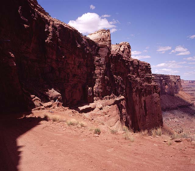
Another photo of the Shafer trail at the beginning of
the trip.
After about an hour, the others arrived. Gambrelli ended up driving the truck,
while Rob, Kathie and me biked up. This meant that I would be the only one to
bike the whole trail - lucky me!
The 1000ft climb turned out to be easier than it looked: the road was smooth and
fairly firm (not sandy), so it was a straightforward, though tiring, plod up in
the lowest gear. But oh the heat! I was going through so much water!
Once on top, only 13 miles on a good dirt road remained, with another (obviously
very gradual) 1000ft of climbing. This was definitely a slog, only Kathie and I
were left on bikes at this point. You'd crest a hill, and see a straight line
extending for miles and miles in front of you. More food, more water, ass getting
really sore, slog slog slog.
A few miles from the end, Damion showed up driving his truck back from the highway.
This made room for Kathie in a vehicle, so now it was down to just me on bike! I couldn't
give up now, only a few miles left!
G and Kathy (I think) in front of Monster Tower on the east side of the mesa (and some
other tower whose name I forget).
McStiff's and the Tamarisk Toilet and LCGSCFE
We ate an early dinner at McStiff's, where the waitress gave me a leaky un-covered half
box for my un-eaten tortellini with marinara sauce, and a paper bag to put it in. WTF?
Then it was off to Potash road to find a campsite to spend the night. But first a dip
in the river! Rob found an underwater ledge he could walk on, and was able to
wade, chest deep, out to a sandbar in the middle of the river. Nearby campers
must have wondered about the speedo underwear man wandering around in
the middle of the river. Look like he was a Terminator just arrived in 2002, ready
to kick some ass.
Felt great to get
the omnipresent red dust off of us!
Okay, now time to look for a campsite. Kathie spotted a narrow road heading up
a side canyon. The road was about 6 feet wide with stiff brush and trees on
either side. Rob drove the truck down it a few hundred yards, but eventually it
became evident that this was a bad idea. The road got worse and worse, and there
was no place to turn around. So now he had to back up a long ways on a road that
was exactly as wide as the truck. The branches kept scraping the sideview mirrors
into a forward position, but finally, after 15 minutes or so, we backed up back
onto the highway.
We drank homemade Sangria (trying to ignore the chunks of decaying fruit), and Rob smeared fragrant
lotion all over himself which got him exciteed cause it smelled just like grandma,
and then we watched the video that people had taken on the trip, and then we went to
sleep and got up really early the next morning to get back to Salt Lake City where I
discovered the fork on my bike is fixed to the frame now, and I tried to fed-ex
my bike back to Seattle instead of getting absolutely gouged by Delta, but the only
difference was I got absolutely gouged by lying cheating greedy scum-sucking Fed-ex people.
But it was all worth it!