Mount Roosevelt June 22, 2002
North side of Chair Peak, from somewhere around Gem Lake

To Ed and my's suprise, the way into Source Lake basin from Alpental was still entirely
on snow, belying the bare hillsides visible above. It had already been warm at this early
morning hour at the Denny Creek
trailhead where we dropped off the other car, but here it was freezing!
A cold wind blew down the valley, no doubt responsible for the still significant forest
snowpack. Super freezing cold!
We passed the cliffs at the base of the ski resort "backcountry" and tried to identify
the now-melted out short ice lines we'd climbed before in winter. We finally saw some cliffs that
looked familar, and pointed the routes out, mentally reconstructing one particular day (where we'd
rappeled, etc...) spent at some tiny flows just past "kiddle cliff".
Once we had it all figured out, we continued on ... only to stumble upon ... "kiddie cliff"!
Thus realizing
that wasn't what we'd climbed at all! Oops. All these little brushy cliffs look the same.
Snow Lake's ice called to us: "walk on me!"
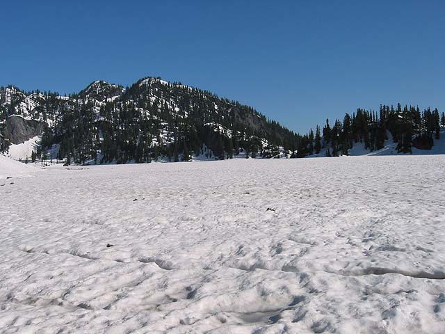
Taking the "winter route" to Snow Lake, we crested the ridge and descended some steep snow to
the lake shore. I mentioned how the trail around Snow Lake is really circuitous and seems longer
than it is. Then Ed suggested we just cross directly, across the "ice". I thought that was
ridiculous, but upon further inspection, it was pretty tempting. We each made forays a short
distance onto the lake "ice" before coming back taking a break and having a bite to eat.
The discussion went from
"I dunno how thick that ice is" to "it looks pretty solid" to
"Why risk crossing?" to "It sure would be neat to cross Snow Lake in June".
We gathered our
packs, and I walked a little further out on the ice, trying to peek into the gaps
to see how thick it was. I heard the ice crack. I hopped back
to solid ground. Okay, maybe not!
We started circumventing the lake.
Ed on the ridge above Gem Lake leading to Roosevelt's summit slopes.
Travel was fairly straightforward up to Gem Lake, and we enjoyed the views of the north slopes
of Chair Peak (The north face was completely bare). Then we followed a steepening ridge towards
Mount Roosevelt. There were old tracks in the snow, which we were looking forward to following,
as it wasn't clear which steep snow patch or brushy gully we should follow to get to the summit.
Unfortunately, the tracks ended at the gentle summit of "North Roosevelt". We peered over a
north-facing slot I'd long noticed on a topo map and thought might provide a good ski. It
did look good, and more moderate than the map would suggest. Open snow slopes continued far
below.
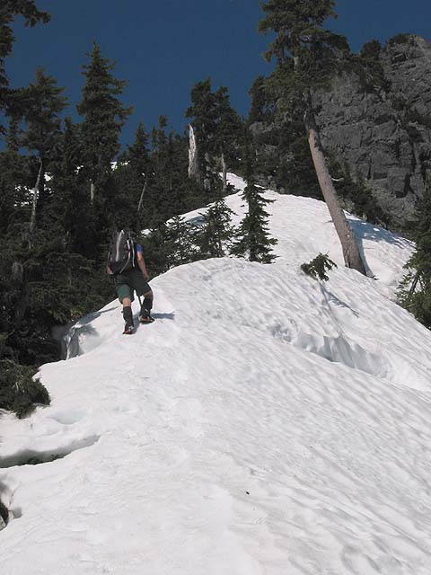
Our way up Roosevelt.

Now to the matter at hand: how to get up Roosevelt? Beckey's imaginary "SE gully" wasn't really
accessible. Really only one option from here, up a steep
slanting snow finger to a melted out foresty gully (facing NE), then to the summit snow patch. It was
a tad exposed, either above cliffs or a bergschrund thing (a bergstorm?).
Me, traversing up the slanting snow finger. photo by Ed Praitis

Ed chose to avoid the second snow patch by scrambling up exposed 3rd class wet heather, while I
made my way up between the snow patch and more solid blocky rock. Both ways were a little tense.
We rejoined, and ascended the final easy rocks to the summit.
Kaleetan-Roosevelt traverse from the summit of Roosevelt.
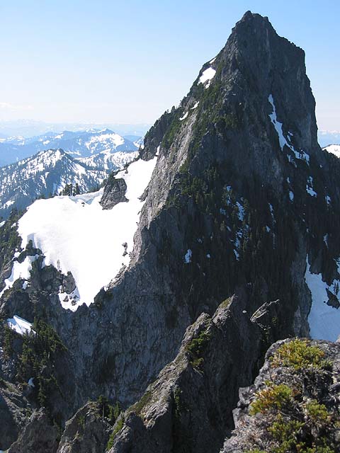
The North Ridge of Kaleetan (our intended route) looked more formidable from here than its mostly 4th class
rating suggested, so we faced
the other direction while we relaxed and ate lunch. It had
taken just under 4 hours from the Alpental parking lot - not a stellar time, but not too shabby. The firm snow on the entire approach
was really nice.
Me scrambling up the last few feet to the summit. photo by Ed Praitis

We opened the summit register and signed our names... looked like we got the "first 2002 ascent"
of Roosevelt. What a delightful honour!
Soaked in the views, ate food, drank water, got harnesses on and gear out, started heading down.
The traverse, from somewhere around Gem Lake. Narrow shaded snow gully at extreme right
figures prominently in our story.
The first ridge obstacle was a steep-looking fin. I thought it looked kind of difficult, and
Ed thought it went off in the wrong direction, so we both figured the route must bypass it.
Looked like there were some ledges of the left side. So we started scrambling around on those.
The ledges took us lower and lower around the fin. It was kind of brushy and yucky, and I was
beginning to lose motivation. It spit us out onto a steep snow traverse, which even included
some slide alder. Eventually, we began to realize that we should have gone over the fin. After
half an hour of brushy 3rd class scrambling, we arrived at a gully leading to the ridge top.
It looked like a steep loose mess of brown dirt which neither of us wanted to climb. The only
other option was a steep snow gully across the way, which looked like it also led to the ridge
(one tower further along). It didn't look that great to me, but we scrambled down onto the
snow, got out the axes again, and traversed over to it.
Ed in the snow gully.

Ed headed up a short ways, but it just didn't feel good to me.
Though the snow was descent - firm with a step-kickable outer 5 inches - the consequences of
a fall here weren't good. A couple of pickets would have been just the thing to set me at ease.
But we didn't have any of course, and any rock pro would be hard to come by (bad rock, and
hard to get to because the snow patch was moated on each side). I also recalled seeing this
gully earlier in the day, and the snow was completely split by a crack near the top.
Our erroneous traverse around the fin (on the left) from the summit.

So we turned around. It was an easy descent into the basin from here. An invisible rock flew
through the air with a whizzing sound, and landed somewhere nearby ("THUNK!"). As we descended,
I saw a more moderate gully that led to the ridge top. Ed was already down below though, and
it turns out that this one was the one split by a crack, obvious from here.
We rounded Chair Peak Lake (burried, with strange holes around the edge, into which I fell up
to my waist), ascended to Melakwa Pass and took a break under the shade of some trees. We
heard some shouts, and saw people on Kaleetan's summit, right above us. The North Ridge looked
nice from here.
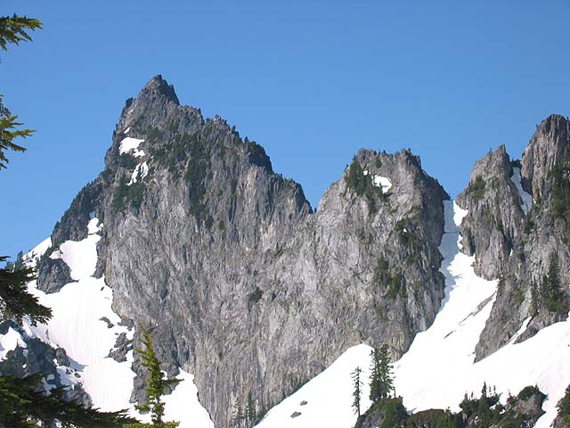
East Face of Kaleentan

The way down to Denny Creek trailhead is a slog. A slog with lots of beautiful waterfalls,
but a slog nonetheless. In the snowy open flats just above Snowshoe Falls, we encountered the
first of several million hikers we would see between here and the trailhead. The first
one, clearly pushing the upper limits of hiker zone, stared at us from across the creek,
seemingly in a scowl. We supposed that she was confused that we were on the opposite side of the
creek from her. We looked back periodically as we continued down the valley, constantly
transfixed by her gaze.
The plethora of waterfalls in this valley is truely amazing. Thin streams
pouring hundreds of feet down the mountainsides, and roaring torrents of Denny Creek.
We reached the trailhead sometime around 4 o'clock, satisfied at least with a long scenic tour
and an "enigma range" summit tick on a sunny day, if not with our intended ridge traverse.