Mt. Maude, North Face, July 1, 2006

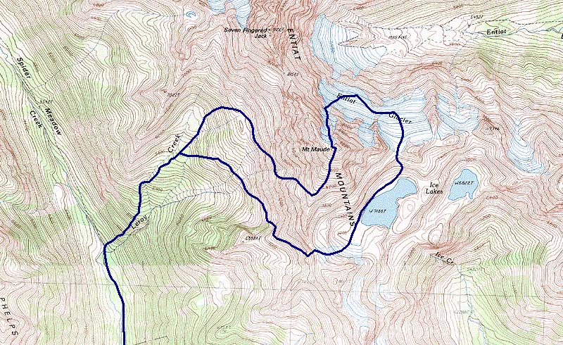
Ryan, Greg and I hiked in from the Phelps Creek trailhead, starting at about 5:30am. I got four hours of totally awesome sleep that night, which was nice.
Up in Leroy Basin, Ryan was feeling the effects of lack-of-sleep, and decided to turn around and nap somewhere. We told him we'd try to be back at the car by 6pm.
I messed up the route finding getting to the south ridge, and we spent quite a while scrambling around in ski boots, trying to get into the broad talus bowl that leads to the ridge. After we got through, Greg said "I knew that wasn't the right way." Thanks Greg!
Shortly after noon, we summitted. I tried to peek over the edge, down to the Entiat Glacier to see if it looked good to traverse to Ice Lakes on that, instead of scrambling back up to the Maude-7 Finger Jack col. Seemed ok.
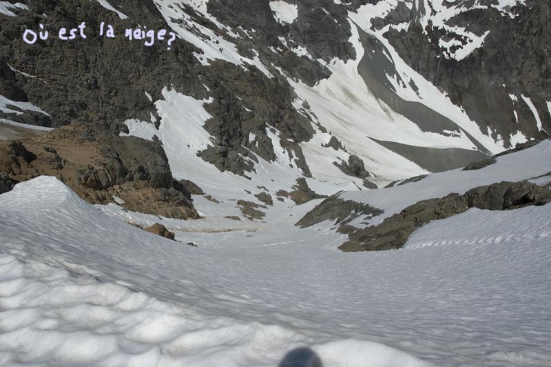
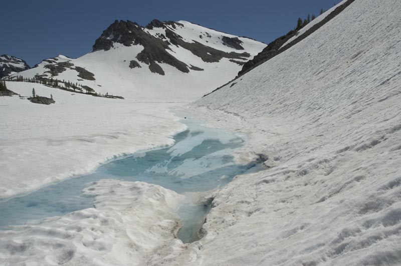
We walked down to the entrace where the slope was finally visible, and the "oh my god that looks to be stupid steep" feeling dissipates. We tried to see if it was continuous snow all the way down. Greg thought it was. I wasn't so sure. I tried to memorize the rocks, so we'd know where to go once we got down there.
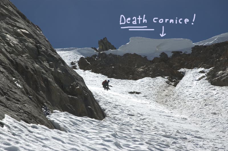
I went first and found slightly crusty punchy snow, but safe enough. The infamous death cornice that had freaked everyone out a year ago was still there, albeit smaller. Its path appeared quite clear though, and it only put us in danger for a few seconds as we crossed its runnel.

Once the slope turned more east, the snow got sloppy and grabby. The middle of the face has substantial traversing (you could take a more direct line in winter). I almost fell into one of the runnels once. That would have sucked. I tried to remind myself to be more careful.


Near the bottom I had to dig up from memory the way off the face. I remembered us deciding up top that we needed to traverse right at the bottom. Problem was, everything on the right was a cliff.
Instead, straight down looked like it might go. There was some good skiing here - the snow was firmer, and the turns more down the fall line.
As you might expect though, I ran into a bergschrund. I looked to be four feet wide or so. I contemplated hucking it, but decided it might not be a good idea considering our rather remote location, and not being able to see into it.
When Greg arrived, I told him to cut left and check out the other side of a rock, where it looked like it might go. It did, and so I side-stepped up, and around the rock.

Now we were on the Entiat Glacier. Instead of a smooth traverse like I had hoped, there were several knolls, making it impossible to see ahead very far. We were right level with patches of crevasses and glacial ice, so we had to either go low or go high. I went low, found cliffs, put skins on, and made a gradual ascent. Soon had to switch to booting.
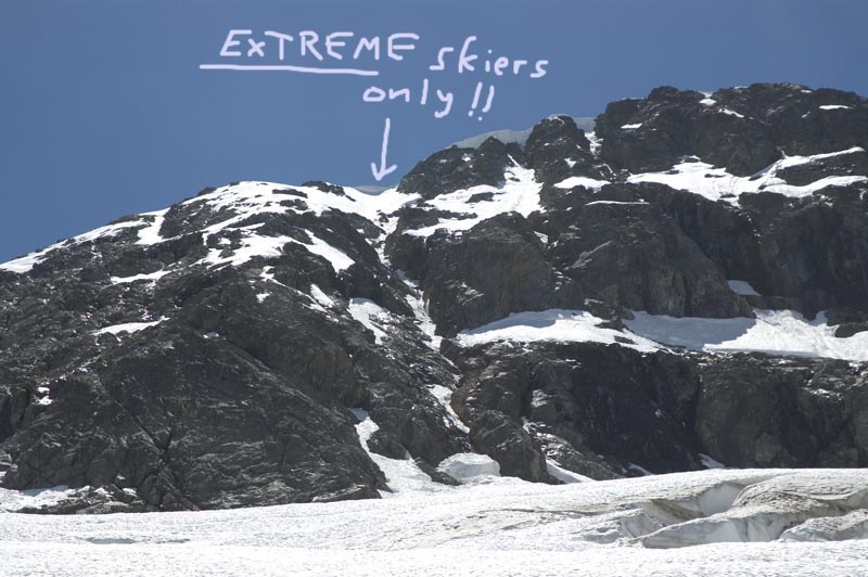
Eventually, we found ourselves approaching the Entiat Icefall. I expected a big nasty melted out debris-filled zone here, but was pleasantly suprised to only find an easy smooth traverse that only put you in danger for a few seconds.

On the other side we had to climb a steep slick slope above an ice cliff, so I switched to booting again.
Soon we were at the col above Ice Lakes. Luckily, we were able to stay almost completely on snow all across the mile long traverse through the lakes' basin. We rejoined the Burgdorfer route, and skied across a ridge into Leroy Basin. At the end of the snow (6300ft), we picked up a path which brought us back to the Leroy Basin trail.
I spent much of the way back picking off caterpillars/worms from my shirt, pants, head, hair and equipment. They were dropping from the trees everywhere - it was freaking me out.